
Interstate 55 in Louisiana
From Wikipedia, the free encyclopedia
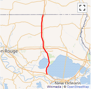
Interstate 55 (I-55) is a part of the Interstate Highway System that spans 964.25 miles (1,551.81 km) from LaPlace, Louisiana to Chicago, Illinois. Within the state of Louisiana, the highway travels 66 miles (106 km) from the national southern terminus at I-10 in LaPlace to the Mississippi state line north of Kentwood.
The route is located in the southeastern portion of Louisiana and parallels the older U.S. Highway 51 (US 51) corridor. While passing through the city of Hammond, I-55 intersects two of the state's major east\west routes, I-12 and US 190. It also serves the smaller city of Ponchatoula, as well as the towns of Amite City and Kentwood.
I-55 is a major highway through the New Orleans metropolitan area, the city being located 20 miles (32 km) east of the junction between I-10 and I-55. It also serves as an important hurricane evacuation route for the region. I-55 was opened in several stages beginning in 1960 with a bypass of Ponchatoula and Hammond. The southern 23 miles (37 km) of I-55, consisting of a twin-span viaduct through the Manchac swamp, was completed in 1979 and is one of the longest bridges in the world....
I-55 LA Exits
Highway I-55 runs South to North with exit numbers starting at the southern most exit of each state or province.
Lodging Fuel Food Vehicle Shopping Entertainment/Tourist Medical Assistance Police Fire Pets Bank/ATM