
Interstate 90 in Illinois
From Wikipedia, the free encyclopedia
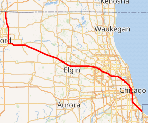
Interstate 90 (I-90) in the U.S. state of Illinois runs roughly northwest-to-southeast through the northern part of the state. From the Wisconsin state line at South Beloit, it heads south to Rockford before heading east-southeast to the Indiana state line at Chicago. I-90 traverses 108 miles (174 km) through a variety of settings, from farmland west of the Fox River Valley through the medium-density suburbs west of O'Hare International Airport, through downtown Chicago, and through the heart of the industrial southeast side of Chicago before entering Indiana.
I-90 comprises several named highways. The Interstate runs along the Jane Addams Memorial Tollway (previously called the Northwest Tollway) from South Beloit to O'Hare Airport, the Kennedy Expressway runs from O'Hare to the Chicago Loop, the Dan Ryan Expressway from the Loop to the Chicago Skyway, and the Skyway to the Indiana state line. The Jane Addams and Chicago Skyway are toll roads maintained by the Illinois State Toll Highway Authority (ISTHA) and the Skyway Concession Company (SCC) respectively. The remainder of the highway is maintained by the Illinois Department of Transportation....
I-90 IL Exits
Highway I-90 runs West to East with exit numbers starting at the western most exit of each state or province.
Lodging Fuel Food Vehicle Shopping Entertainment/Tourist Medical Assistance Police Fire Pets Bank/ATM