
Interstate 81 in Virginia
From Wikipedia, the free encyclopedia
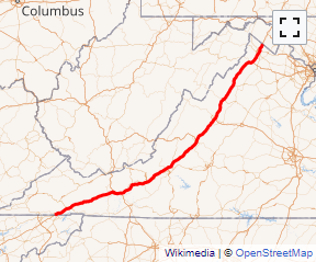
Interstate 81 (I-81) is an 855-mile-long (1,376 km) highway. In the U.S. state of Virginia, I-81 runs for 324.92 miles (522.91 km), making the portion in Virginia longer than any other state's portion. It is also the longest Interstate highway within the borders of Virginia. It stretches from the Tennessee state line near Bristol to the West Virginia state line near Winchester. It enters Virginia from Bristol, Tennessee, and leaves Virginia into Berkeley County, West Virginia....
Full Wikipedia TopicI-81 VA Exits
Highway I-81 runs South to North with exit numbers starting at the southern most exit of each state or province.
Lodging Fuel Food Vehicle Shopping Entertainment/Tourist Medical Assistance Police Fire Pets Bank/ATM